 |
| (Photo: Baodulich.net.vn) |
Between June and December is the best time to put on your backpack and hit the trail.
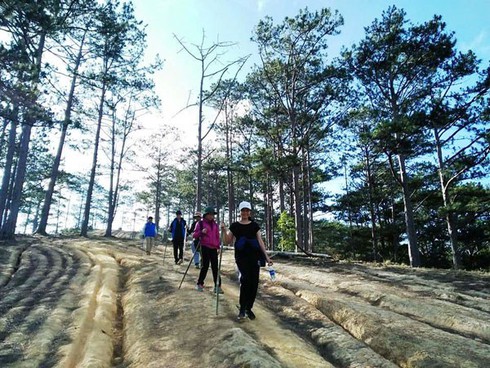
The route is approximately 55 kilometers stretching over three provinces: from Ta Nang commune in Lam Dong, through Ninh Thuan, to Phan Dung commune in Binh Thuan. You start off on a three-kilometer winding hill path to the edge of a lush green forest.
The two-day-one-night trek is long and challenging. Hill after hill awaits you on the first day. Some slopes are so steep you must use your hands to climb them.
Hoang Van Quang, one of the very first tourism service providers in Ta Nang commune, said, “This area has two seasons including the rainy and dry season. There are two branches of the route: one goes around the hills and one passes through Yaly waterfall. Most trekkers opt for the Yaly waterfall route in the rainy season, when the grass is plentiful and shiny-green."
According to Quang, you are advised to book a tour which can provide your group an experienced leader, meals, and tents. Tour companies work with the forest management forces, who can rescue travelers who become exhausted or lost in the forest.”
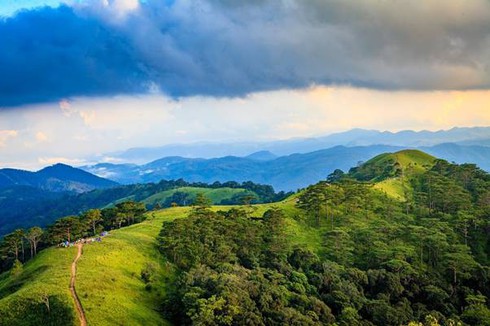
The trekking may burn you out but it’s worth it for the captivating landscape - green or brown meadows that stretch to the horizon, endless green forest, and a chill wind that cools your skin and fills your lungs with fresh air.
“This is the first time I’ve been to Ta Nang – Phan Dung. I don’t remember how many hills I’ve climbed. The higher I climb, the more ravishing the landscape becomes. Every time I trek over a hill, an immense windy green field appears. The farther I go, the more eager I am to reach the finishing point.”
“I’m attracted to the primeval forest beauty. The landscape from hill after hill is truly unspoiled. I’m really excited to see the remains of ancient giant trees felled by time and not by forest logging.”
They were some reviews by trekkers of the Ta Nang - Phan Dung route.
 |
|
Ta Nang - Phan Dung is one of the most scenic trekking routes in Vietnam. (Photo: baolamdong.vn) |
The Ta Nang – Phan Dung milestone at an altitude of 1.7 kilometers is a check-point where trekkers take photos of puffy clouds and rest their legs before continuing up the winding hill path to the overnight camping site at Hai Cay Thong (two pine trees) hill. Now, it’s time to enjoy the sunset, inhale the cool air, set up your tent, and eat some dinner.
Tour guide Nguyen Hoang Anh Duy told VOV, “Trekkers spend one night in the forest in Phan Dung commune. Gathering around the campfire, roasting sweet potatoes and chicken, having a chinwag, and enjoying specialties made by the locals makes for fond memories of this trek. Take your time and enjoy a vast ocean of clouds.”
On the second day, you’ll take on the challenge of 12 kilometers downhill and then 4 kilometers over sand and rocks passing by small waterfalls, brooks, reeds, and shady trees. When you reach the other side of the forest at around 4pm, you have completed your Ta Nang – Phan Dung trek, a serious challenge even for skilled trekkers. VOV