 |
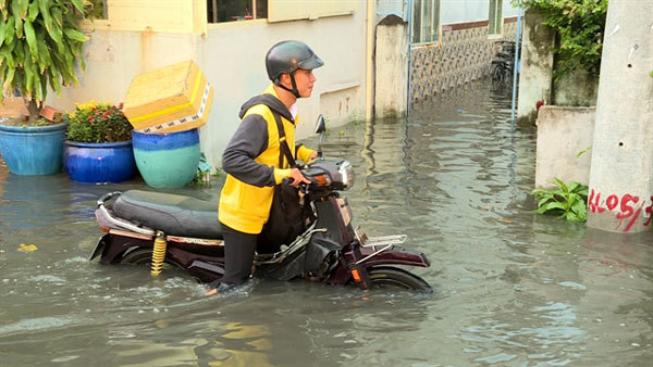
| A street flooded due to high tides in HCM City’s District 8. — VNS Photo Ngoc Diep |
There are six warning levels, with more than 5m being the maximum.
The centre said the tides at Phu An and Nha Be stations on the Sai Gon-Dong Nai rivers rose to a record 1.68-1.70m on the two days.
The peak times are from 5am to 7am and 4pm to 6pm.
The centre has issued flood warning level 2 for until Wednesday.
On Sunday afternoon in District 8’s Me Coc Street, the tide caused 30m of the embankment to collapse, badly flooding the entire area near Kenh Ngang Bridge No 3.
Members of the self-defence force in the district’s Ward 16 were piling sandbags past 1am on Monday to create a temporary embankment there.
But the water continued to pour in, and with the inundation above 50cm motorbikes, especially, and cars found it difficult to traverse the road.
Nguyen Mai Trung, chairman of the district’s Ward 15, said repairs are being carried out on the damaged embankment and water is being pumped back into the river.
Implementation of an environmental improvement project there had affected the embankment and caused it to break, he said.
On September 29 flooding of 0.3-0.5m occurred on many streets in districts 2, 8, 7, Nha Be, Binh Thanh, Binh Tan, and others.
Mekong Delta
In the Mekong River, water levels are expected to be 0.2-0.3m higher than the flood warning level 3 because of high tides and water simultaneously flow down from the upstream region.
The centre has warned that local authorities and the public should be prepared for flooding in low-lying areas and near rivers.
Most streets in the Can Tho City centre on Monday were flooded by up to 0.5m, leading to traffic congestion.
At Con Khuong Islet in Ninh Kieu District of Can Tho, water from the Hau River broke a dyke, flooding houses and orchards. VNS